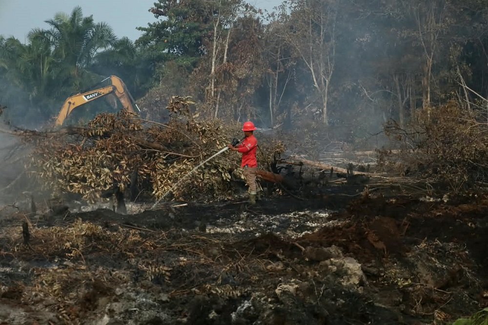
en.malanginspirasi.com – The area of land affected by forest and land fires (karhutla) in Riau Province has increased again, according to the latest daily report by Regional Disaster Management (BPBD).
It was stated an additional 87.9 hectares of burned land were recorded.
The Head of the Riau Province and Fire Department (BPBD and Damkar), Edy Afrizal, stated that the largest increase occurred in Pelalawan Regency, with 64.4 hectares.
With this increase, the total area of land burned in Pelalawan since the beginning of 2026 has reached 6,705.39 hectares.
“This daily report continues to change based on the situation on the ground each day. Based on the data we received yesterday, an additional 87.9 hectares of burned land were recorded,” said Edy.
Also Read:
An Orangutan Named Sempurna Dies from Smoke Inhalation in Kalimantan Fires
In addition to Pelalawan, Indragiri Hilir (Inhil) Regency also experienced an additional 10.5 hectares of burned land, bringing the total to 1,044.52 hectares.
A similar increase of 10.5 hectares also occurred in Indragiri Hulu (Inhu) Regency, bringing the total burned area in the region to 615.52 hectares.
In Rokan Hulu (Rohul) Regency, the burned area increased by 0.5 hectares to 34.46 hectares. Meanwhile, the Meranti Islands and Kuantan Singingi (Kuansing) each experienced an increase of one hectare.
With these increases, the total burned area in the Meranti Islands reached 218.45 hectares, while in Kuantan Singingi it was 70.87 hectares.
Meanwhile, the regencies of Siak, Bengkalis, Rokan Hilir (Rohil), Kampar, and the cities of Dumai and Pekanbaru reported no increase in burned area in the latest report.
Based on cumulative data since January 1, 2026, Bengkalis remains the region with the largest burned area in Riau, at 8,454.40 hectares.
Pelalawan was next with 6,705.39 hectares, followed by Indragiri Hilir with 1,044.52 hectares, Indragiri Hulu with 615.52 hectares, and Dumai with 556.01 hectares.
Furthermore, Rokan Hilir recorded 452.53 hectares, Siak with 373.06 hectares, Meranti Islands with 218.45 hectares, Kampar with 141.66 hectares, Pekanbaru with 103.33 hectares, Kuantan Singingi with 70.87 hectares, and Rokan Hulu with 34.46 hectares.
Overall, the Riau Regional Disaster Management Agency (BPBD) and Fire Department (Damkar) reported that the area burned since early January 2026 has reached approximately 18,770 hectares.
“This is the overall data as of early January 2026,” explained Edy.
According to Edy, the development of forest and land fires in all regencies and cities is being continuously monitored. Response efforts are being adjusted to conditions and needs on the ground, using both ground and air operations.
This response involves various joint elements, including the Indonesian National Armed Forces (TNI), the Indonesian National Police (Polri), the Riau Provincial Regional Disaster Management Agency (BPBD), the district/city BPBDs, and Manggala Agni.
“We continue to monitor the development of forest and land fires in each region and are responding according to conditions and needs on the ground,” said Edy.