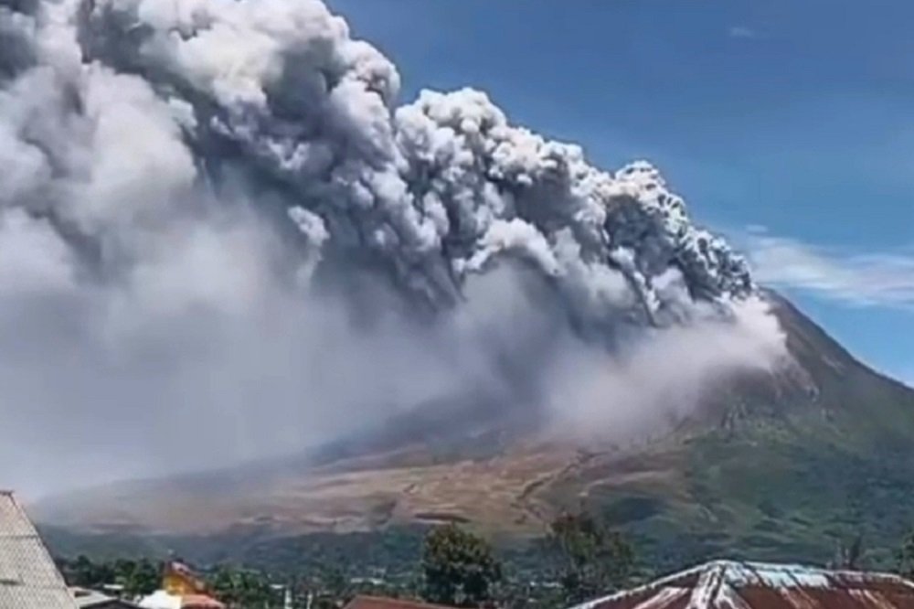
en.malanginspirasi.com – The erruption of Mount Sinabung took place on Monday morning, August 31, 2026, blasting a thick black column of volcanic ash approximately 3,500 meters above its summit after days of heightened seismic activity.
The eruption began at 10:17 a.m. local time (Western Indonesian Time) and lasted roughly one hour.
The ash plume, which reached about 5,960 meters above sea level, drifted east and southeast. Seismographs recorded the event with a maximum amplitude of 120 millimeters.
Indonesia’s Geological Agency (Badan Geologi) raised the volcano’s alert status from Level II (Caution/Waspada) to Level III (Alert/Siaga), effective 12:30 p.m. local time.
Officials advised residents, visitors, and tourists to avoid relocated villages and prohibited activities within a three-kilometer radius of the summit, plus an expanded sectoral zone of up to six kilometers in the south-southeast direction.
Authorities also warned people living near rivers flowing from the volcano to stay vigilant against potential lahars (volcanic mudflows or cold lava floods), especially if heavy rain occurs.
Also Read:
Mount Merapi Sends Pyroclastic Flow, Authorities Maintain Level III Alert
Gray ash blanketed roads, vehicles, and buildings in several nearby villages in Karo Regency.
Local officials distributed protective masks, and some residents left their homes voluntarily, though no mandatory evacuations were ordered.
No injuries, deaths, or immediate disruptions to flights were reported.
The Geological Agency described the event as an initial eruption and noted the possibility of larger activity, urging the public to remain calm and rely on official information.
Increased activity had been detected in the preceding period, including dozens of volcanic earthquakes (reports cited around 85 volcanic quakes plus other tremors before the blast).
Tourism sites such as Lau Kawar Lake and a nearby camping area had already been closed as a precaution.
Mount Sinabung, a roughly 2,460–2,600-meter stratovolcano on Sumatra, had been largely dormant for centuries before awakening in 2010.
It has experienced recurrent eruptions since then, including deadly events in prior years.
The Geological Agency and the Center for Volcanology and Geological Hazard Mitigation continue close monitoring, with status reviews ongoing based on visual and instrumental data.
Residents and authorities in the region remain on alert as observations continue.